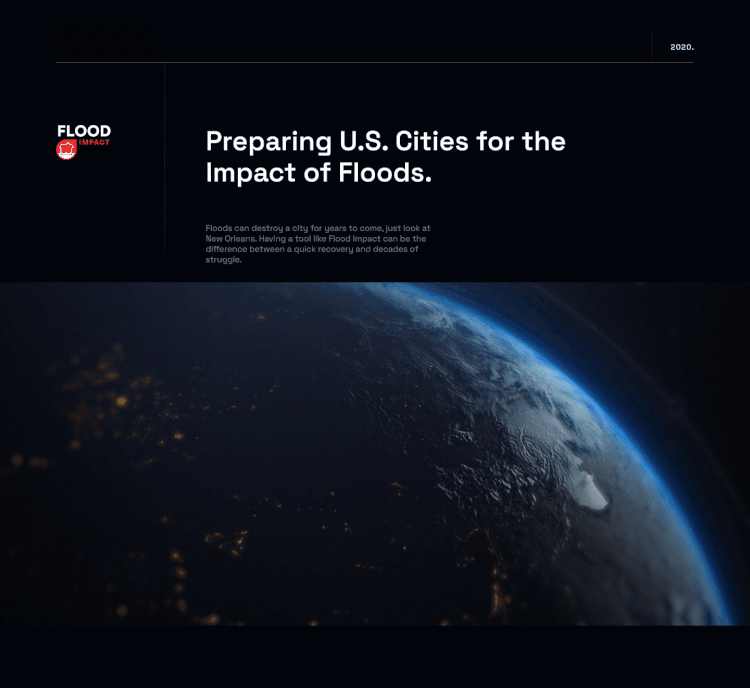
About
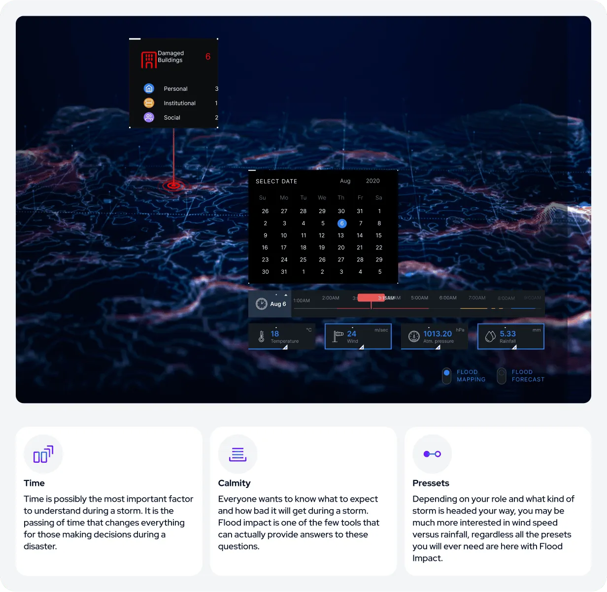
When preparing for a disaster as devastating as large-scale flooding, the ability to forecast future impacts offers a significant advantage for states, cities, and communities. The Flood Impact AI tool enables users to anticipate how quickly critical “red zones”—the most vulnerable areas—will become submerged following a major storm. It also provides insights to help mitigate damage and expedite public notifications.
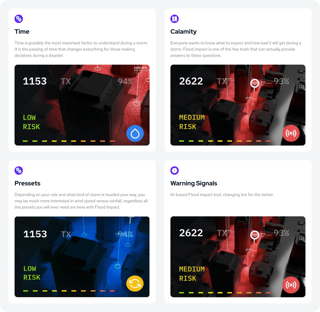
Storm Center Filtering System
It is not only the speed or intensity of the storm that matters; factors such as the elevation of affected areas, total rainfall, storm size, and storm type collectively influence evacuation protocols, public alerts, and the extent of potential damage and loss of life. The broader the adoption of a tool like Flood Impact, the more effectively communities can prepare for and respond to the next major even
Timeline
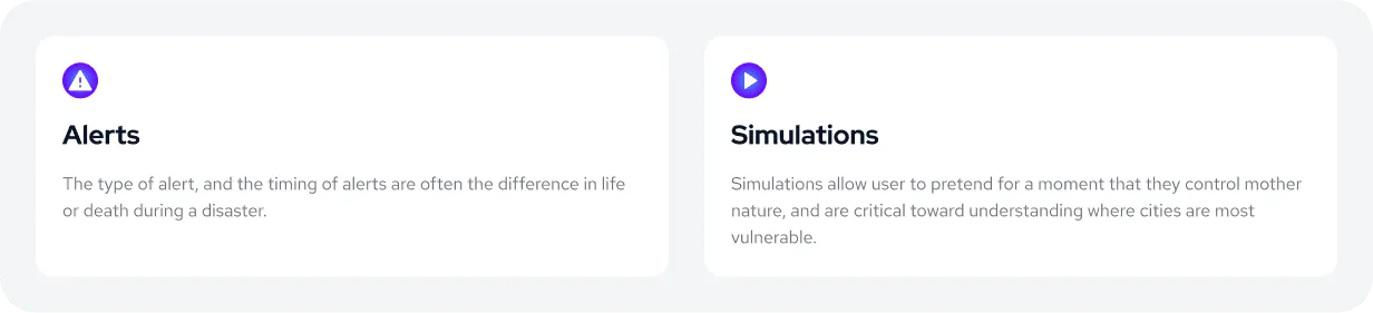
People often have an inherent tendency to rationalize their decisions, and many are reluctant to disrupt their routines—even in the face of a major hurricane. Emergency responders know this all too well: despite alerts and evacuation orders, there will always be individuals who attempt to ride out the storm. Accurately predicting when and how severely these individuals will be impacted is critical for first responders, enabling them to better protect their own safety while working to reduce the potential loss of life.
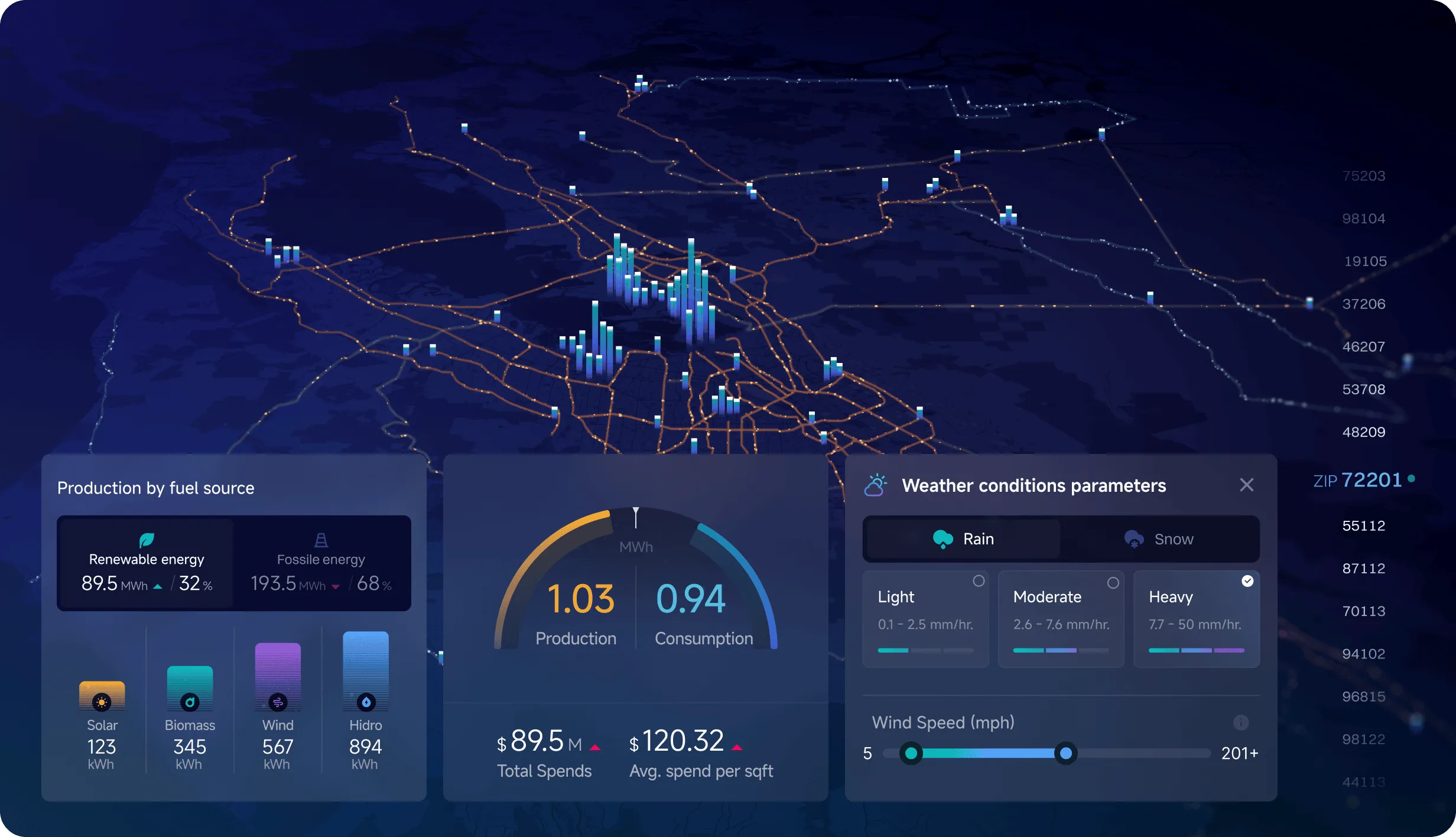
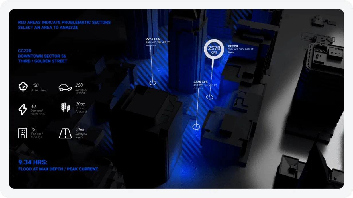
Central Metropolitan District
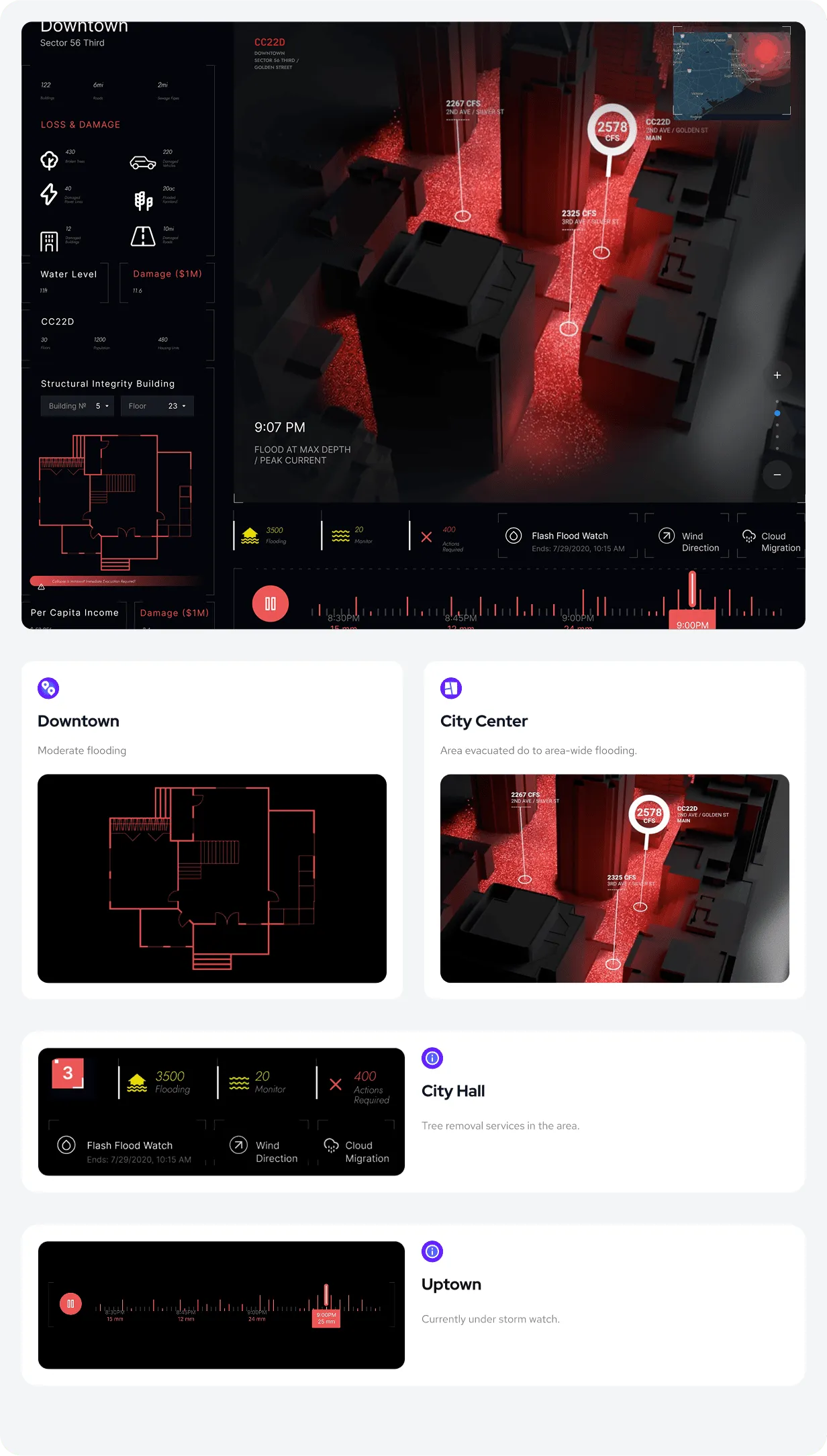
Large cities, or metropolitan centers, often lack the capacity to manage heavy rainfall or flooding as effectively as rural communities. This makes them particularly vulnerable to widespread damage during severe weather events.
In densely populated urban areas, the demand for controlled drainage, protective barriers, evacuations, and accurate property damage assessments can shift rapidly. To minimize costs and mitigate destruction, city managers require timely, predictive insights to guide critical decision-making.
Planning Transformed by GIS and AI
Historical storms are not always reliable predictors of how future floods will affect a region. However, GIS mapping and topographical data remain constant, and when combined with AI-driven simulations, they allow cities to model flood scenarios more accurately. This enables municipalities to allocate budgets more effectively, prioritize departmental resources, and secure essential supplies that often become scarce during emergencies.
The tool also highlights how varying weather patterns demand different regional response strategies. By selecting a ZIP code and adjusting scenario variables, users can gain valuable insight into potential outcomes and develop more informed preparedness plans.

Zip by Zip & Block by Block
In dense urban environments, every detail matters when it comes to flood management and prevention. Gutters, drains, hills, and surrounding buildings all influence how water moves through a city. Subterranean structures—such as parking garages and below-ground building levels—carry unique risks that must be carefully assessed.
With accurate forecasts and predictive insights, building managers can better anticipate these vulnerabilities and adapt their strategies, transforming how they prepare for and respond to major storms.