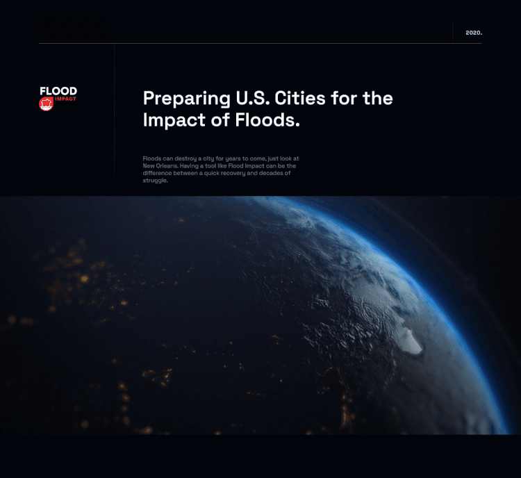
Revolution in Drone Technology

User Research
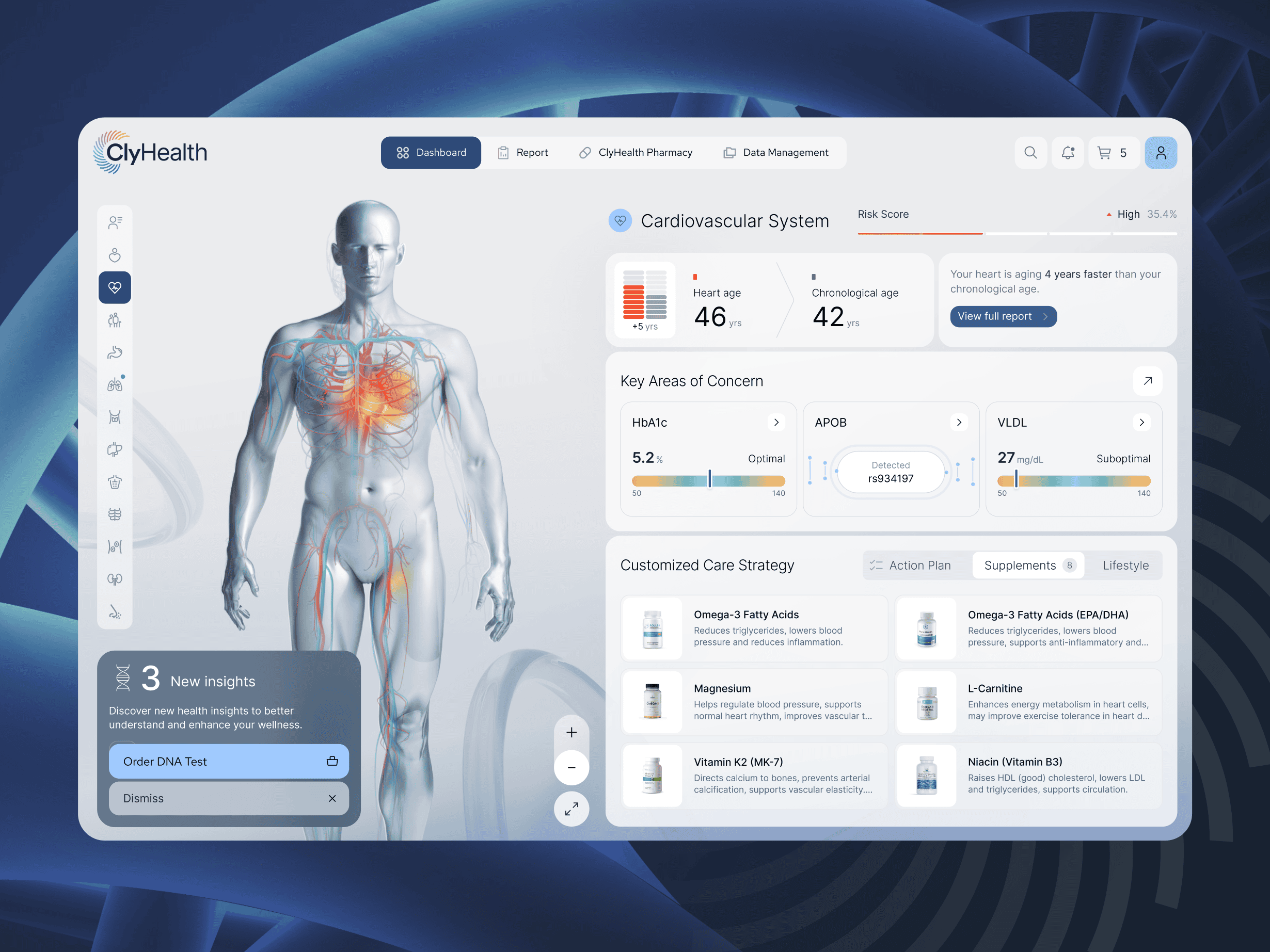
We initiated our UX research by crafting detailed user personas to represent all potential users of the drone system. This included farmers aiming to optimize their irrigation systems by identifying areas of water scarcity and waste. Additionally, we developed personas for ranchers focused on monitoring and managing their grazing herds to prevent overgrazing in specific areas.
Overview
Here’s a clearer rephrasing:We started with UX research and built detailed user personas to represent all foreseeable drone-system users. These included farmers looking to better monitor irrigation—identifying where water is most needed and where it’s being wasted—and ranchers focused on tracking and managing grazing herds to prevent overuse of specific pasture areas.
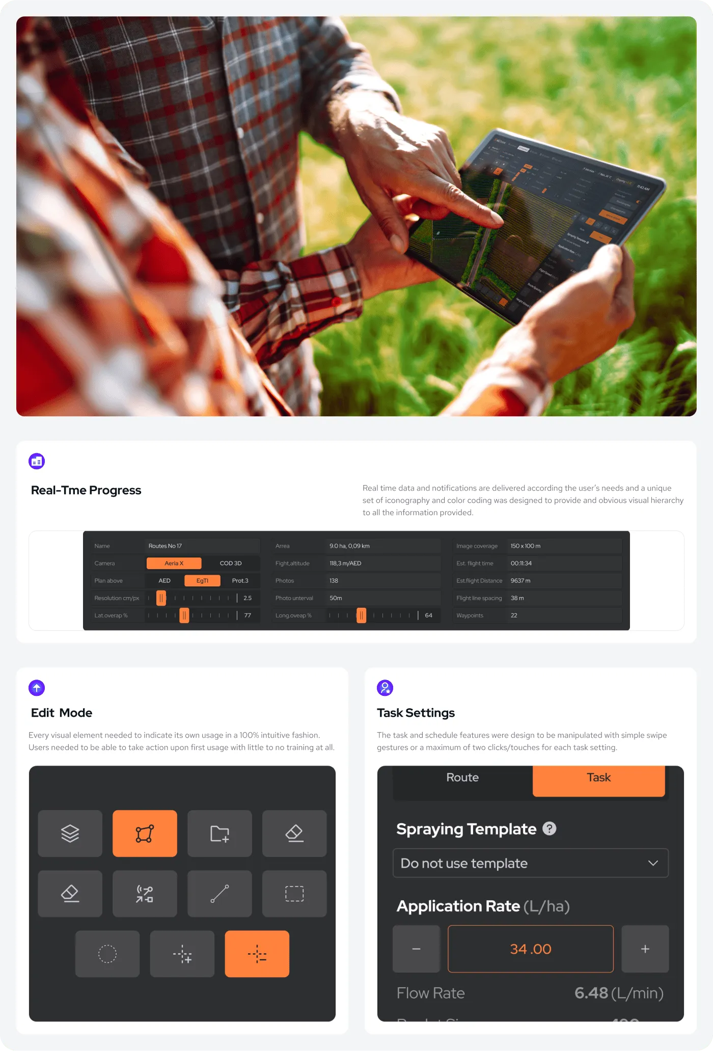
Real-Time Overview
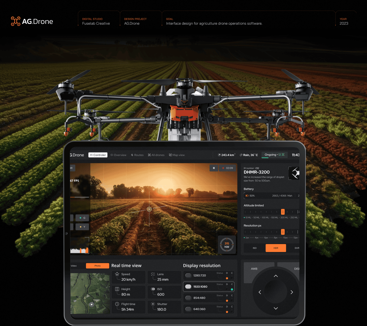
With AG.Drone, users can systematically plan land and livestock management based on weather patterns and real-time data—capabilities that were impossible just a few years ago. The UX/UI was validated through real-world testing across diverse conditions, including rain, thunderstorms, and extreme heat.
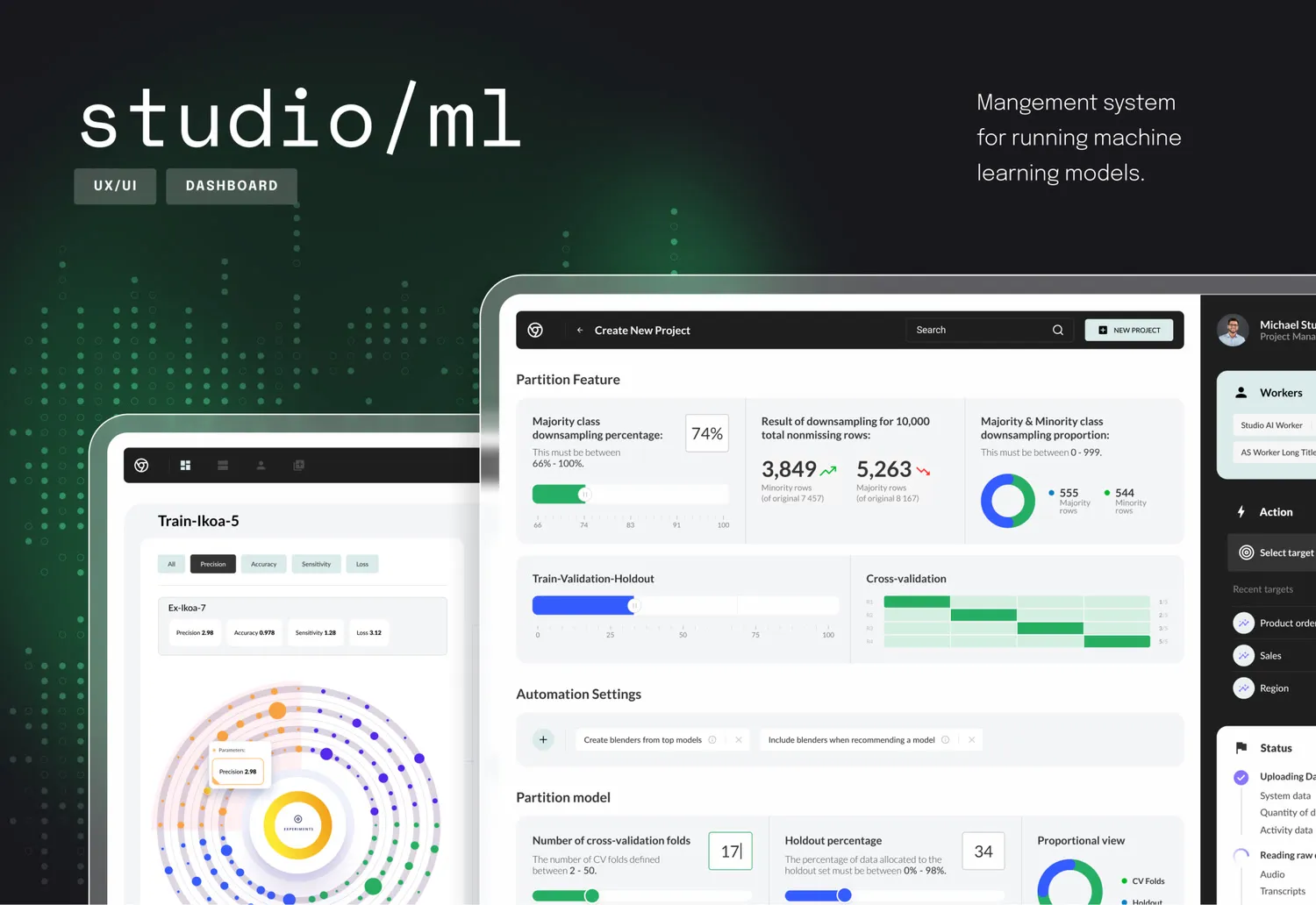
Dashboard
Nearly every visual element in the UX/UI delivers an actionable insight or task. The interface is as appealing as it is practical, quickly becoming the go-to tool in the shed for land managers and agricultural staff who previously relied solely on firsthand experience before drone technology transformed this vital sector of the global economy.
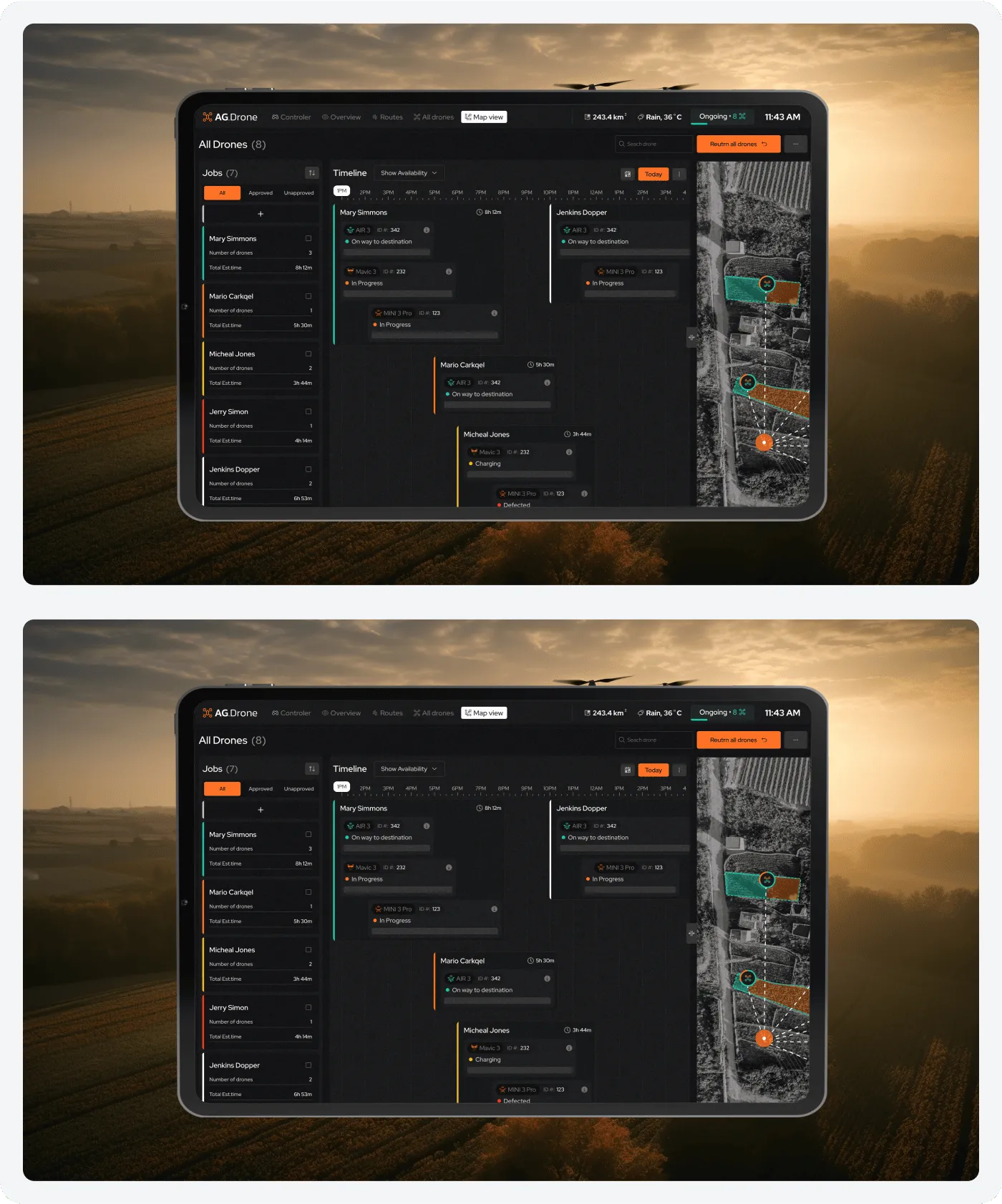
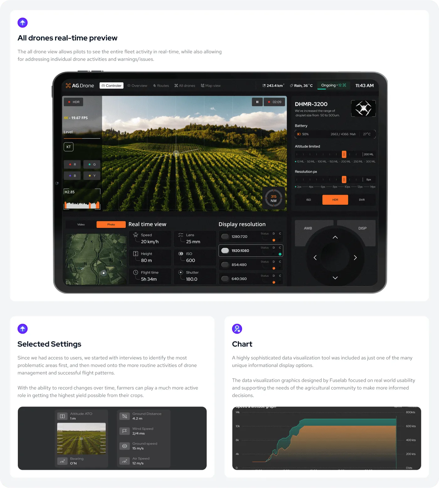
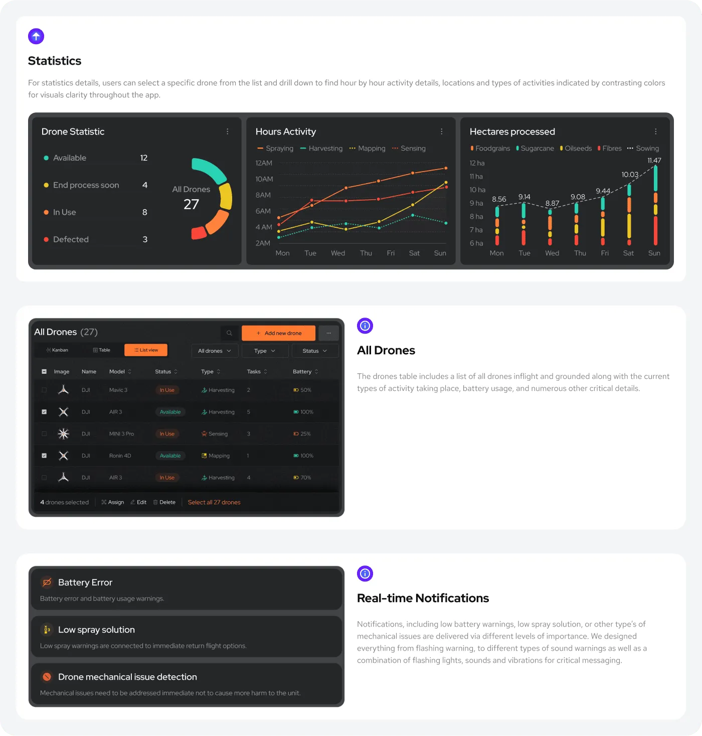
Drone Management
For effective land management—especially on large farms or with livestock—multiple drones are essential. Our interface supports simultaneous control of multiple aircraft and provides real-time alerts for issues requiring immediate attention.
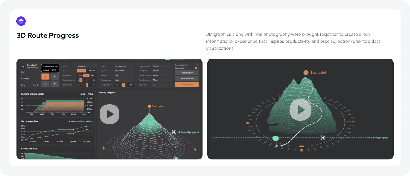
Route Management
Unlike recreational drone software, this platform required a precise, pixel-perfect mapping interface so users can clearly see what’s been completed and which sectors still need attention.

Map View
Not every user manages drones the same way. That’s why we designed multiple experience modes—such as real-time map control for individual drones and minute-by-minute timeline management.

Scheduler
The drone route scheduler dashboard provides real-time tracking and optimization tools to plan missions efficiently and safely.